|


This page last updated on
01/26/2019.
Copyright © 2001-2019 by Russ Meyer
| |
"The pilot...who has been able to say, `Neptune, you shall never sink this ship
except on an even keel,' has fulfilled the requirement of his art." -
Seneca, circa 63 A.D.
On the first trip to Washington, I learned a lot about long cross
countries, weather, seat-of-the-pants piloting skills, etc. It was a
fabulous experience. I thought that would be the end of long cross
country flights for several years, but I got another shot at it. Once
again, in 1998, the required money, time, and justification all came together.
This time my friend Tom asked me to be Best Man in his wedding. If we had
to go all the way to Washington, we might as well take our family vacation
there. While we were there, we could attend my
family's annual reunion too. So, it was back into the plane and back to
Washington for Jane,
Serena, Katie, and I. We rented a Cessna 172, tail
number 9635H, packed it with our gear and took off. This is my flight log
from that trip:
- 6/20 Addison, TX -> Liberal, KS 4.1
hours
Landed at Meade...they had no fuel. With 5 gal auto gas, flew to
Liberal.
It was a perfect day to begin a long cross-country. The weather along
our route was clear all the way. We got an early start and were off by
8:00
AM. I planned to stop at Meade, Kansas for fuel. I had never been
to Meade, but both the sectional and Flight Guide said they had fuel available
and that the field should be attended. The flight was uneventful, and we
dropped into Meade low on gas. I taxied up to the fuel
truck and shutdown. We got out of the plane and walked to the
office. It was open, so we went in. No one was there. We
waited 20 minutes, but there was no sign of anyone. I
looked in the Flight Guide, and it gave a couple of phone numbers for
after-hours refueling. I called those numbers and left messages on
answering machines. We waited some more. After a half-hour,
I started rummaging around the office. If I could find the fuel truck
key, I could pump the gas myself and leave some cash in a drawer with a
note. I had no luck finding the truck key, but I found keys to a whole
bunch of other things on the field. Kind of careless for them to leave
the office unlocked like that with all these keys and stuff just lying
about. I went out to look at the fuel
truck. I could tell it had been parked a long time. The tires were
half flat, and tumbleweeds had collected underneath it. I looked at the
fuel sight gauge on the side of the tank and noticed about 3 inches of rust
colored water. I doubted they had pumped much fuel from that truck in a
long time. I stood out on the ramp thinking. As near as I could
calculate, we had 7 gallons of usable fuel left. That was enough to fly
another 30 minutes at 75% power with a 30 minute reserve. It should be
possible to reach Liberal, Kansas where I knew I could get fuel. The
only problem was that there was some uncertainty in my fuel calculations.
If I guessed wrong on a couple of things, we could have as little as 3 gallons
of fuel left. That would put us on the hairy edge of fuel exhaustion
enroute to Liberal. I thought of leaving Jane and the kids while I went
for gas. I could come back later and pick them up. At least I
wouldn't have to subject the entire family the risk of an off field landing.
I didn't see any readily available alternatives, so that became the plan.
Before trying it, I decided to make one last ditch effort to get gas here.
I went back to the office, and tried calling the Meade police department.
I explained our predicament to the dispatch lady. She said she would send a patrol car out. The
patrolmen arrived, assessed our situation, asked us to sit tight, and departed. I had no idea what in the world he could possibly do.
After about 30 minutes, an old guy pulled up outside. He got out and
came in. "You the people that need gas?" Yeah, we need gas.
I was getting a Wray, Colorado deja vu feeling here. "The police
stopped by my house and said someone was stranded at the airport. I got
an airplane here on the field, that's why they came and got me. Two guys
bought this FBO a few months ago, and they're doing a horrible job of running
it. They're always gone and there's no way to get fuel. The fuel
in that truck is all bad. It's a darned shame. Guys fly in here
all the time looking for gas, and there ain't none. It's a trap!"
Well, I was open to any suggestions he might offer. "I got an airplane
in that hanger over there. I bring in cans of auto gas to fuel my plane.
How much gas you need?" I figured 5 gallons would be enough to get us to
Liberal no sweat. "OK, come on then." I got in his car and we
drove a few miles down the road to a gas station. We filled up his 5
gallon gas can and headed back. I poured the gas in the tanks. We
thanked him profusely and took off for Liberal. I didn't want to waste
any more fuel than absolutely necessary, so as soon as we were at 1000 feet AGL, I leveled out
and throttled way back. I was a little worried about detonation and the
possibility of vapor lock using auto gas, so I went ahead and ran the engine
full rich. That and the low RPMs would keep the temperature down and
detonation at bay. We got to Liberal and topped off the tanks.
Based on the amount they put in, I back-computed how much
gas we must have had on the ground in Meade. It was 7 gallons, so my
original calculations were right; how about that! Altogether, we had wasted about 3½ good, daylight hours fooling around with this Meade thing. Grrrr...
- 6/20 Liberal, KS -> Sidney, NB 2.8
hours
Bumpy flight to Sidney. Serena puked all over. Nice but goofy
people at Sidney.
We took off out of Liberal after about a 30 minute stay. It was hot and
bumpy. Serena lost it about half way through the flight and puked all
over the front of the airplane. Uughhh...I was getting to dread puking
passengers on these flights. Jane managed to get it pretty well cleaned
up in about 10 minutes. We landed in Sidney at dusk. The FBO
people there were really nice, but kind of excessively gregarious in a weird,
mentally ill sort of way. I liked them and they seemed instant
pals, but I got this funny uncomfortable feeling when I turned my back on
them, so I didn't. They gave us a courtesy car for the night, and we
drove into Sidney. After getting a hotel room, we ventured out and drove
around town for a while. Nice little neighborhoods, but the town has
this really isolated feel, almost like you're way out in the Australian
outback or something. In fact, Sidney is a long way from anything,
although the interstate passes through there.
- 6/21 Sidney, NB -> Sheridan, WY 3.1
hours
Good flight to Sheridan. Flew through cloud bases (below). Had
lunch and played in park.
We arrived at the airport around 8 AM. I still had a funny feeling about
these FBO guys. I took my time looking over the airplane, checking the
fuel, etc. 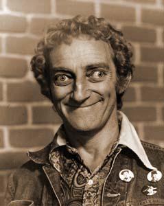 I have to admit I was a little nervous that someone might
have tampered with the plane while we were away. I had absolutely no
evidence that anything like that had happened, but I was just uncomfortable
with the maniacal ear-to-ear grins, bulging eyes, and Marty Feldman looks of
those guys. They seemed to be buzzing all around us asking personal
questions and continuously offering help of various kinds. I felt like a
bug in a jar. If one of the kids dropped a pacifier, a guy would run
over from the hanger and pick it up for us in literally seconds, offering it
to Jane with that same bulging eye, foot wide bizarre grin. Sometimes,
two of them would make a break for us at once. I pulled the dipstick out
to check the oil, and in a flash two guys converged on me offering clean rags
to wipe the dipstick. Fifteen seconds later, a
third fellow arrives at the scene of the oil checking to inform me that he had
already looked at the oil for me this morning and found it OK. No need
for me to bother checking it myself. Well, I'm kind of anal about these
things I chuckled and tried to conceal my alarm at their behavior. With
lots of help, we blasted out of Sidney headed for Sheridan. We had no
weather troubles enroute. It was partly cloudy with bases
around 7500 feet. As we approached Sheridan, the bases gradually dropped
to about 5500 feet. When we entered the pattern at Sheridan, we picked
up some turbulence. On final and during the landing flare, the wind
seemed to gust and change direction a lot. It was a struggle to set the
plane down smoothly. When we finally got out and tied down,
there didn't seem to be much wind at all...hmmm. We took a courtesy car
into town and grabbed a bite to eat at a burger shop. On our way back to
the airport, we stopped at a park for an hour to let the kids play. We
got back to the airport and departed for Missoula, Montana. I have to admit I was a little nervous that someone might
have tampered with the plane while we were away. I had absolutely no
evidence that anything like that had happened, but I was just uncomfortable
with the maniacal ear-to-ear grins, bulging eyes, and Marty Feldman looks of
those guys. They seemed to be buzzing all around us asking personal
questions and continuously offering help of various kinds. I felt like a
bug in a jar. If one of the kids dropped a pacifier, a guy would run
over from the hanger and pick it up for us in literally seconds, offering it
to Jane with that same bulging eye, foot wide bizarre grin. Sometimes,
two of them would make a break for us at once. I pulled the dipstick out
to check the oil, and in a flash two guys converged on me offering clean rags
to wipe the dipstick. Fifteen seconds later, a
third fellow arrives at the scene of the oil checking to inform me that he had
already looked at the oil for me this morning and found it OK. No need
for me to bother checking it myself. Well, I'm kind of anal about these
things I chuckled and tried to conceal my alarm at their behavior. With
lots of help, we blasted out of Sidney headed for Sheridan. We had no
weather troubles enroute. It was partly cloudy with bases
around 7500 feet. As we approached Sheridan, the bases gradually dropped
to about 5500 feet. When we entered the pattern at Sheridan, we picked
up some turbulence. On final and during the landing flare, the wind
seemed to gust and change direction a lot. It was a struggle to set the
plane down smoothly. When we finally got out and tied down,
there didn't seem to be much wind at all...hmmm. We took a courtesy car
into town and grabbed a bite to eat at a burger shop. On our way back to
the airport, we stopped at a park for an hour to let the kids play. We
got back to the airport and departed for Missoula, Montana.
- 6/21 Sheridan, WY -> Missoula, MT 3.7
hours
Good flight to Missoula at 8500'. Scattered T-storms.
The weather was great enroute to Missoula. Just a few scattered
thunderstorms, but nothing that posed any difficulty for us. We landed
in Missoula in late afternoon, got fuel, a coke, and some snacks.
- 6/21 Missoula, MT -> Walla Walla, WA
2.7 hours
Smooth flight to Pullman. Made great landing in Pullman for once.
Dodged T-storms on way to Walla2.
While we were on the ground in Missoula, a thunderstorm had been developing
about 10 miles Southeast of the field, and now appeared to be moving our
direction. We hurried to load up and take off. I didn't want to
get caught on the field, pinned down by a thunderstorm. Our destination
was Pullman, Washington where I would drop off Jane and the kids with Jane's
parents. I would then proceed to Walla Walla to spend some time with
family and friends. The air was calm on approach to Pullman. For
once, I made a perfect soft landing! I always seem to prang the airplane
down in Pullman. This was a first for my flying career...whoohoo! Jane's parents met us on the ramp.
I said my good-byes and headed for Walla Walla. As I approached Walla
Walla, I flew into an area of scattered thunderstorms. They were easy to
avoid. Closer to the airport, the tower warned me that a
thunderstorm had just passed over the field. I saw the storm, but it had
drifted way off to the northwest and was now just a light rain
shower. It was small and isolated, and didn't seem threatening. I
alighted on the rain soak runway, taxied over to the FBO, and
tied down. I called my Mom, who trekked to the airport to pick me
up.
- 6/23 Walla Walla, WA (local flight)
1.0 hours
Duck pond hunting with Dave C. Got into some wave lift.
I spent a lot of time in Walla Walla with my buddy Dave.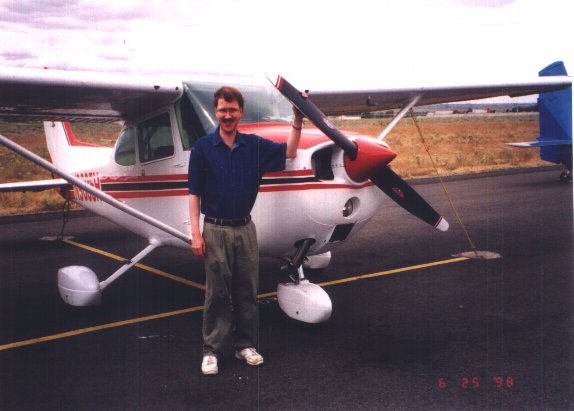 We
kicked around a lot. He's an avid duck hunter. He suggested that
we buzz around looking for a certain duck hunting pond he was interested in.
That sounded like a good enough reason to go flying, so off we went. We
headed west down the valley. There was a 25 knot South wind making the
air turbulent as it spilled off the ridges Southwest of Milton-Freewater. We
bounced around the valley circling this pond and that with no particular
destination in mind. Finally, Dave had enough of circling round and
round in turbulence. We climbed higher and headed South. I leveled
at 2500 feet, planning to fly over Milton-Freewater then turn back north over Spofford before returning to the airport. About half-way between Walla
Walla and Milton-Freewater there was a big jolt and the vertical speed
indicator pegged at 2000 feet per minute up. I throttled back
and pointed the nose of the plane down. We accelerated to about 110
knots in the shallow dive before the VSI needle dropped off the upper peg just
slightly. We were still going up at almost 1600 feet per minute.
This was cool...I'd read stories about wave lift, and always wanted to see
what it was like. All the stories I had read involved wave lift over big
mountain ranges like the Sierras. I didn't think you could get a decent
wave off these 1000 foot ridges. The lift was very smooth, only an occasional
ripple of turbulence. At about 6500 feet the lift began to
weaken, it was down to about 800 feet per minute...still pretty good. In
a few minutes the sun would set, and I wanted to get back to the airport.
I reluctantly turned down wind and headed for home. In a few minutes,
we were out of the area of lift and in a fast power-on descent to pattern
altitude. That was fun. It would have been really neat to shut
down
the engine and just glide around in that lift for a while. I bet I
could have stayed up a long time. Maybe I'll try that someday. We
kicked around a lot. He's an avid duck hunter. He suggested that
we buzz around looking for a certain duck hunting pond he was interested in.
That sounded like a good enough reason to go flying, so off we went. We
headed west down the valley. There was a 25 knot South wind making the
air turbulent as it spilled off the ridges Southwest of Milton-Freewater. We
bounced around the valley circling this pond and that with no particular
destination in mind. Finally, Dave had enough of circling round and
round in turbulence. We climbed higher and headed South. I leveled
at 2500 feet, planning to fly over Milton-Freewater then turn back north over Spofford before returning to the airport. About half-way between Walla
Walla and Milton-Freewater there was a big jolt and the vertical speed
indicator pegged at 2000 feet per minute up. I throttled back
and pointed the nose of the plane down. We accelerated to about 110
knots in the shallow dive before the VSI needle dropped off the upper peg just
slightly. We were still going up at almost 1600 feet per minute.
This was cool...I'd read stories about wave lift, and always wanted to see
what it was like. All the stories I had read involved wave lift over big
mountain ranges like the Sierras. I didn't think you could get a decent
wave off these 1000 foot ridges. The lift was very smooth, only an occasional
ripple of turbulence. At about 6500 feet the lift began to
weaken, it was down to about 800 feet per minute...still pretty good. In
a few minutes the sun would set, and I wanted to get back to the airport.
I reluctantly turned down wind and headed for home. In a few minutes,
we were out of the area of lift and in a fast power-on descent to pattern
altitude. That was fun. It would have been really neat to shut
down
the engine and just glide around in that lift for a while. I bet I
could have stayed up a long time. Maybe I'll try that someday.
- 6/25 Walla Walla, WA -> Kennewick, WA
0.6 hours
Buzzed over to tri-cities w/Dave for lunch. Gusty 20 kt wind made for
crappy landing.
Back in early 1987, I presented myself and a fist full of dollars to Chad
Heims, the resident flight instructor at Vista Field in Kennewick, Washington. I traded
$2700 and 6 months of my free time for his patient instruction and earned my
wings on July 13th. It's the best $2700 I
ever spent; a bargain by any measure. I really wanted to go back and
visit the field where I whiled away so many happy hours.
My trusty pal, Dave, went with me. The wind was gusty and blowing a good
20 knots.
It tossed us around the sky. In the pattern at Vista Field, I just wasn't
able to get the final approach stabilized; the result was a hard landing.
Not an auspicious arrival after all these years. I entered the FBO
office. Everything had changed. The layout of the office, the
people, etc. I spoke to the guy behind the counter. He said Chad had moved on less than a year ago. I was
surprised he lasted all those years of instructing. He must have
developed an iron clad patience and tolerance for terror over the years. Dave and I grabbed a courtesy
car and drove into town for a leisurely lunch.
After lunch, I wanted to drive by the house Jane and I lived in when we were
first married. I got some photos of it as well as the old nuclear site
where I first worked when I got out of school. It was a real trip down
memory lane. On the way back to the airport, Dave and I decided to zip
up to Spokane, just for the heck of it. I entered the FBO
office. Everything had changed. The layout of the office, the
people, etc. I spoke to the guy behind the counter. He said Chad had moved on less than a year ago. I was
surprised he lasted all those years of instructing. He must have
developed an iron clad patience and tolerance for terror over the years. Dave and I grabbed a courtesy
car and drove into town for a leisurely lunch.
After lunch, I wanted to drive by the house Jane and I lived in when we were
first married. I got some photos of it as well as the old nuclear site
where I first worked when I got out of school. It was a real trip down
memory lane. On the way back to the airport, Dave and I decided to zip
up to Spokane, just for the heck of it.
- 6/25 Kennewick, WA -> Spokane, WA 1.2
hours
Buzzed up to Felts Field on a lark. OK landing, not my best. With
Dave.
It was a little bumpy, but we climbed high and got out of most of the ground
turbulence. The turbulence was mostly due to the wind. On the way
up, we flew over an area of eastern Washington known as the "scablands."
Here the land had been scoured clean during
the great Missoula Lake floods of the last ice age. Huge tracts devoid
of plant life, the underlying bedrock exposed and sculpted by torrential
waters. The Palouse hills nothing but giant sand ripples on the bottom
of a glacial stream, the scale of which boggles the mind.
We arrived in Spokane with an unceremonious thump. I was having
trouble with my landings today; they'd all been a little rough. We checked around for
courtesy cars, but there were none. There didn't seem to be any place to
go sit for a while and shoot the breeze over a coke. The people we
encountered didn't seem very friendly. In the end, it was just a bust.
We gassed up, piled in, and blasted off for points South.
- 6/25 Spokane, WA -> Walla Walla, WA
1.9 hours
Cruised over the wheat fields at 100 to 500 feet AGL. Saw deer and elk.
W/Dave.
After takeoff, we climbed to about 2500 feet until we were clear of the Spokane
area. The wind had slacked considerably. Dropping down to about 200 feet, we cruised along at 90 knots.
I knew this Palouse country. It was so soothing to drift over wheat mantled hills
like a dandelion seed on the wind.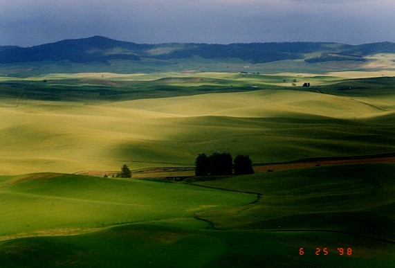 We passed 10 miles
west of Pullman.
Approaching the Snake river canyon, we dropped down to about 50 feet.
Flying between the saddle-back of the hills, we suddenly launched out into the chasm. In a flash there
were a thousand feet of air beneath us. Suspended over the void, we
turned following the river west
into the afternoon sun. Over-flying Lower Granite dam, we headed Southwest and
left the Snake behind. Skirting wheat fields at 500 feet, we drifted
over Pomeroy then Dayton, and up into the foothills of the Blue mountains. There were deer amongst the
wheat fields and tree lines. Eventually, we overflew Kooskooski canyon
and the Walla Walla water shed, finding elk
in the mountain meadows. The sun hung low on the horizon, and we
headed for home. We passed 10 miles
west of Pullman.
Approaching the Snake river canyon, we dropped down to about 50 feet.
Flying between the saddle-back of the hills, we suddenly launched out into the chasm. In a flash there
were a thousand feet of air beneath us. Suspended over the void, we
turned following the river west
into the afternoon sun. Over-flying Lower Granite dam, we headed Southwest and
left the Snake behind. Skirting wheat fields at 500 feet, we drifted
over Pomeroy then Dayton, and up into the foothills of the Blue mountains. There were deer amongst the
wheat fields and tree lines. Eventually, we overflew Kooskooski canyon
and the Walla Walla water shed, finding elk
in the mountain meadows. The sun hung low on the horizon, and we
headed for home.
- 6/26 Walla Walla, WA -> Pullman, WA
0.7 hours
To Pullman for Tom's wedding. 25 kt tailwind.
It was time to get up to Pullman for Tom's wedding.
My Mom drove me to the airport. I said a temporary good-bye and
departed. I would see her again in a day or two up at the
cabin in Idaho. It was very windy, and I had a strong tailwind all
the way to Pullman. I made good time and a decent landing. Jane, the kids, Jack, and Sandy met me at the
airport. I spent some time with Tom that day. He and Rebecca were
married on the 27th. A fine wedding. At the reception
afterward, I saw some familiar faces. Folks I hadn't seen in years.
It was fun.
- 6/28 Pullman, WA -> Priest River, ID
1.5 hours
To Priest Lake for family reunion. Flew through rain. Very hairy
go-around.
We stayed in Pullman until after lunch. I called my Dad and told him I would buzz the cabin when we arrived. He said they had a bit
of rain that morning, but the sky had now cleared. The plan was to land
at Priest River. We finally departed around 1:00 PM. The flight up
was fine until we got to Spokane. There we encountered some low clouds
that eventually merged to form an overcast. Almost every time I had
flown through the Priest Lake area in the afternoon, I had run into low clouds and rain. Today was no exception. Just
north of
Priest River, we found scattered rain showers. To maintain VFR, I had to
deviate east and come over the lake around Blue Diamond Marina. I
dropped down and buzzed the cabin a few times. A little door opened and
several little figures filed out; some waving. We waggled our wings and
headed for Priest River. The rain and low clouds had moved east and we had no problem proceeding directly to the airport,
although we had to deviate around occasional isolated scud. I entered left
downwind for runway 01 at Priest River. I noticed some dark
clouds about five miles west headed our way. It looked
like we would be on the ground well before they arrived. I continued
around the pattern turning base then onto an extended final. As I
rolled onto final approach, we picked up some turbulence. Initially, I
attributed it to wind spilling over a ridge about
½ mile upwind to the west. As we continued on final, the turbulence got worse
and worse until it was shaking us up pretty bad. I began to realize that
this may not be simple wind induced ground turbulence. Glancing west, it
appeared those dark clouds had advanced quite a bit, now seemingly
only two or three miles away. A few seconds later, I saw the trees on the
ridge top begin waving wildly back and forth. I could also see some
debris being lifted into the air off the top of the ridge. Gust front!
Those were not just dark clouds, they were an embedded thunderstorm. The
increasing turbulence was likely a side-effect of the advancing gust front.
It was on a collision course with us. We would both arrive over the
approach end of the runway at about the same time. I decided to abort
the approach...the last thing I needed was to be low and slow, beginning a
flare, and get hit with this huge blast of gusty wind 90º
off the runway heading. I had about 100 feet of altitude and was on an 1/8
mile final when I gave it full power and retracted 10º
of flaps. Almost simultaneously the gust front hit us. The plane bucked
around pretty bad. We got knocked about 75 feet east of the runway centerline. I
crabbed into the wind to stay lined up with the runway. There were tall pine trees on either side
of the field, and I needed as much ground clearance as I could get. The
plane was pitching up and down alarmingly. It was a fight just to keep the nose
anywhere near the horizon. The airspeed was winding and unwinding about 20 knots
with the stall warning horn bleating periodically. Worst of all, we were
not climbing. In fact, our rate of
descent remained entirely unchanged even with the engine roaring at full
power. There was nothing I could do but just ride the plane down.
In a flash, I decided that if the plane was pushed all the way to the ground,
I would try to impact in a level attitude, cut power, and get it stopped.
I very much wanted to hit the runway rather than the grass or trees, so I
tried hard to keep the plane headed towards the runway. This was difficult because the wind
continued pushing us east
of centerline, even with a 30º crab angle.
The descent finally stopped 20 feet above the ground. There was a wind sock on a pole just
east of the
runway; we cleared it by 10 feet. I was now half-way down the runway,
and there was almost no way to land without running off the end. I tried
to maintain best rate of climb speed, but the stall warning horn was still
complaining as the airspeed bounced all over the place. We were just holding level at
full power. Now other problems became apparent. We were struggling
to maintain 20 feet of altitude, but there were 30-40
foot trees at the
end of the runway, and ½ mile beyond them, a
tree lined bluff several hundred feet high. I had a fleeting thought of
forcing the plane down onto the remaining runway. Maybe I could
force a ground-loop and stop before smashing into the trees. All we needed
was another 15 or 20 feet and we'd clear them. Very gradually, the plane started to climb. We vaulted over the trees with 40 feet to
spare, right into a wall of horrific turbulence.
The plane bucked and rocked hard enough to be disorienting and the instruments
shook so much they were a blur. We had
managed to rise 200 feet above the trees, but now the plane started slowly
sinking again. We were barely hanging on. I desperately needed
airspeed, but dared not ease off flaps. That would have put us at high
risk of sinking into the trees. The bluff ahead
was getting uncomfortably close, and at this rate we would not
clear it. I looked around for options. Just in front of the bluff
was a small stream bed. The stream flowed from northwest to Southeast.
I could alter our heading 30º left and fly
upstream to the northwest, paralleling the bluff. That would buy us few
minutes. I hesitated for a second because banking the plane would cause
us to sink closer to the trees, now only about 100 feet below, but I really
had no choice. I had to turn or impact the bluff, so I turned to follow the stream,
losing about 20 feet in the process. After a minute,
the airplane picked up a lot of speed and started climbing normally again.
What a relief. I eased off the remaining flaps, turned north, and
climbed out over the bluff that had blocked our path earlier. We were
still getting thrown about in strong turbulence, but at least we had some air
under us. That was the hairiest go-around I've ever had. Man, I
don't want to go through that again. We had another problem though.
I didn't want to loiter since we could be set upon by the storm approaching from the
west. I thought about turning South to land at Coeur
d'Alene, Idaho, however, with each passing minute, the turbulence was less and
the wind seemed to be moderating. The gust front had moved through, and
it looked like things had improved. I decided to try the landing again.
My plan was to take a look at the windsock while on downwind. If it looked bad,
I would head to Coeur d'Alene. I re-entered left downwind for runway 01. The windsock indicated a moderate, slightly gusty, 30 degree
crosswind. It shouldn't be a problem. I proceeded through the
pattern. We were still being rocked by turbulence, but it wasn't as bad
as before. I kept a lot of excess speed and power on final approach, and
only used 10º of flaps. Everything seemed OK.
At
100 feet, I cut power and slowed. We touched down, braked
hard, and rolled off onto the taxiway. Whew! We taxied over and
shut down. I hurriedly tied the plane down, just in case another huge
gust came our way. About 10 minutes later, it started raining.
About 15 minutes after that, my Mom and Dad arrived to pick us up. I was
still kind of shook up from the experience, and felt shaky and drained for an
hour or two. Man, oh man...
- 6/29 Priest River, ID (local flight)
1.0 hours
Sightseeing with Lori and Dad. OK landing.
While at the cabin, I suggested that we take a sightseeing flight up over the
lake. My Dad and sister, Lori, came along. We drove out to the
airport and took off. The day was a bit windy, but bright and sunny.
First up was an over-flight of the cabin. I got down to about 100 feet
above the water and flew in a straight line paralleling the shore, right in
front of the cabin. We made several passes and took some pictures.
The cabin lies out on the tip of a broad peninsula. I would fly past,
do a steep 180º turn, and fly past again.
I got the feeling my Dad was a little uncomfortable with this maneuver.
I asked him about it, and he said he was fine...I don't know. It
caused me to think critically about what I was doing. It probably wasn't
the best idea in the world to be performing a hard turn like that so close to
the ground. If I stalled for some reason, it would be real ugly.
There had to be a better way, but I couldn't think of a different way to
approach it at the moment. After looking at the cabin, we turned north
and climbed out over the lake. It was beautiful.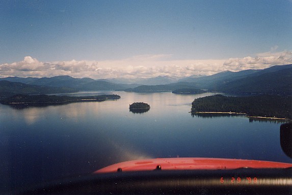 When we got to
the north end of the lake, we turned around and headed for the airport.
We flew along the mountains on the east side of the lake, looking at old
forest fire damage. We dropped into the pattern at Priest River.
Left downwind for runway 01 again. We navigated the pattern, immersed in
moderate to heavy turbulence. I suddenly noticed that my hands were hurting. Looking down at my fingers, I realized
I was gripping the control yoke so hard my knuckles were white. I
guess I was still shook up about that go around we did the last time I landed
here. I tried to relax, but it was hard. On final, we were bounced
around so much that I couldn't stabilize the approach. We were too high
and were being blown east of centerline by a stiff breeze. About halfway
down final, I aborted the approach and went around for another try.
Maybe I was letting bad memories get to me or something, but I had this deja
vu feeling. Our second approach worked out much better, and we landed
OK, but I had to fight the turbulence hard all the way to the ground. After we landed and got out of the airplane, I realized that I
was very tense. I know the memory of that nail-biting go around the day
before was affecting me. It was a challenge to see if I had the nerve to
get back into the plane and operate it with confidence again. I
wondered if Dad and Lori sensed my tension. Hope not. When we got to
the north end of the lake, we turned around and headed for the airport.
We flew along the mountains on the east side of the lake, looking at old
forest fire damage. We dropped into the pattern at Priest River.
Left downwind for runway 01 again. We navigated the pattern, immersed in
moderate to heavy turbulence. I suddenly noticed that my hands were hurting. Looking down at my fingers, I realized
I was gripping the control yoke so hard my knuckles were white. I
guess I was still shook up about that go around we did the last time I landed
here. I tried to relax, but it was hard. On final, we were bounced
around so much that I couldn't stabilize the approach. We were too high
and were being blown east of centerline by a stiff breeze. About halfway
down final, I aborted the approach and went around for another try.
Maybe I was letting bad memories get to me or something, but I had this deja
vu feeling. Our second approach worked out much better, and we landed
OK, but I had to fight the turbulence hard all the way to the ground. After we landed and got out of the airplane, I realized that I
was very tense. I know the memory of that nail-biting go around the day
before was affecting me. It was a challenge to see if I had the nerve to
get back into the plane and operate it with confidence again. I
wondered if Dad and Lori sensed my tension. Hope not.
- 7/3 Priest River, ID -> Coeur d'Alene, ID
1.3 hours
Sightseeing with Dianne and Elaine. Went to Coeur d'Alene for gas.
The next batch of jolly sightseers were my sisters, Dianne and Elaine.
We planned to fly over the cabin then buzz down to Coeur d'Alene for gas and
lunch. After takeoff, enroute to the cabin, I tried to think of a better way to
make our low passes. Something that didn't involve hard maneuvering.
Then I realized all I had to do was fly a really large circle, with one part
of the circle coming approximately parallel to the shoreline. Well duh!
The airplane would be turning, but at a constant shallow bank angle; it seemed
inherently safer. To give the passengers a clear view of the cabin would
mean I would have to fly right turns. That meant that about
¾ths of the circle would be over
the peninsula. So, on every circuit, I would have to climb
up over the peninsula, then drop back down low over the water. That
didn't seem to pose a problem, but I was worried the noise of the plane
over other cabins would upset some people. I decided to climb to clearance height out over the water and throttle way back over the
peninsula to keep the noise down. We would be in a
descending right turn as we cleared the peninsula, so I wouldn't need much
power. That should keep the noise to a minimum as we swept down past the
cabins on the shoreline. I felt pretty good about that plan, so that's
what we did. It worked out fine and we snapped a few more pictures of
the cabin.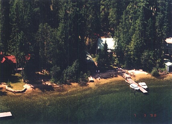 We cruised up the lake a bit and
then turned towards Coeur d'Alene. I was getting low on fuel, and didn't
want to mess around much more than I had too. I should land in Coeur
d'Alene with a 30-35 minute fuel reserve. That was cutting it pretty
close and I chastised myself for allowing my reserve to get that low.
Everything would probably be OK, but it would reduce my options should
something unexpected happen...like a deterioration in the weather. So
far, the weather had been nice. Less wind and turbulence than I'd had on
previous flights, partly cloudy, and moderate temperatures. We should be
OK. Nevertheless, I throttled back and leaned out to conserve fuel, just in case. When
we arrived in Coeur
d'Alene, there were a lot of aircraft in the
sky, and we had to do some extended maneuvering to safely enter the
pattern. See, there's an unexpected event that caused us to use more
fuel. We were still fine, but I took note that a series of these kinds
of incidents would have created a very uncomfortable situation. We cruised up the lake a bit and
then turned towards Coeur d'Alene. I was getting low on fuel, and didn't
want to mess around much more than I had too. I should land in Coeur
d'Alene with a 30-35 minute fuel reserve. That was cutting it pretty
close and I chastised myself for allowing my reserve to get that low.
Everything would probably be OK, but it would reduce my options should
something unexpected happen...like a deterioration in the weather. So
far, the weather had been nice. Less wind and turbulence than I'd had on
previous flights, partly cloudy, and moderate temperatures. We should be
OK. Nevertheless, I throttled back and leaned out to conserve fuel, just in case. When
we arrived in Coeur
d'Alene, there were a lot of aircraft in the
sky, and we had to do some extended maneuvering to safely enter the
pattern. See, there's an unexpected event that caused us to use more
fuel. We were still fine, but I took note that a series of these kinds
of incidents would have created a very uncomfortable situation.
- 7/3 Coeur d'Alene, ID -> Priest River, ID
0.9 hours
Back to Priest River. Dodged T-storm. Landed in heavy rain.
5 min. later, hail.
We left the plane at the FBO to be fueled and walked to the airport cafe for
lunch. Unfortunately, it was closed. We thought about taking a
courtesy car into town for a bite, but decided to just head back to the cabin.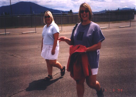 When we returned to the FBO, I discovered the airplane needed less gas than I
thought. Turns out we landed with a 40 minute fuel reserve...that
wasn't bad. We got in and took off. The clouds had thickened a
bit, but it was still a good flying day; partly cloudy with just a light
breeze. We took off and headed directly for Priest River. When we
were about 15 miles South of Priest River, I saw a rain
shower ahead. It looked like it was a few miles Southeast of the
airport. It was just an isolated little shower. There was no
reason to fly through the rain underneath, so I altered course west to fly around it.
As we swung around the shower, I noticed that the cloud from which
the shower emanated was growing. The shower was rapidly becoming more intense.
This thing was on its way to becoming a full blown thunderstorm. In the
15 minutes it took for us to navigate around this little shower, the clouds
around us began to build up ominously. The atmosphere had become very
unstable and it looked like all points on the compass were in overdrive
generating a multitude of little proto-thunderstorms. I wanted to get on
the ground as quickly as possible, before the situation in the air got out of
hand. I couldn't believe how fast this stuff was developing! We
approached Priest River from the west. The little shower had graduated
to heavy rain status, and had drifted northwest, toward the airport. We flew into the
northwest edge of the rain as we
maneuvered to enter the pattern at Priest River. Visibility dropped to
about four miles, but there was no perceptible wind or turbulence. I
entered left downwind for runway 19, and flew the pattern as quickly as I
could. Remembering the gust front we encountered several days ago, I
kept power on and was ready for a go around all the way through final.
On short final, when I knew we were going to make it, I cut power and dropped
full flaps. We touched down just fine, but the runway had about a half
inch of standing water on it. I expected to hydroplane, and we did.
I used the brakes sparingly so as to not aggravate the situation. We
slowed and taxied off the runway. I quickly shutdown and immediately ran
to the upwind wing to tie it down first, just in case a big gust from the
storm hit us. It was raining hard.
When we returned to the FBO, I discovered the airplane needed less gas than I
thought. Turns out we landed with a 40 minute fuel reserve...that
wasn't bad. We got in and took off. The clouds had thickened a
bit, but it was still a good flying day; partly cloudy with just a light
breeze. We took off and headed directly for Priest River. When we
were about 15 miles South of Priest River, I saw a rain
shower ahead. It looked like it was a few miles Southeast of the
airport. It was just an isolated little shower. There was no
reason to fly through the rain underneath, so I altered course west to fly around it.
As we swung around the shower, I noticed that the cloud from which
the shower emanated was growing. The shower was rapidly becoming more intense.
This thing was on its way to becoming a full blown thunderstorm. In the
15 minutes it took for us to navigate around this little shower, the clouds
around us began to build up ominously. The atmosphere had become very
unstable and it looked like all points on the compass were in overdrive
generating a multitude of little proto-thunderstorms. I wanted to get on
the ground as quickly as possible, before the situation in the air got out of
hand. I couldn't believe how fast this stuff was developing! We
approached Priest River from the west. The little shower had graduated
to heavy rain status, and had drifted northwest, toward the airport. We flew into the
northwest edge of the rain as we
maneuvered to enter the pattern at Priest River. Visibility dropped to
about four miles, but there was no perceptible wind or turbulence. I
entered left downwind for runway 19, and flew the pattern as quickly as I
could. Remembering the gust front we encountered several days ago, I
kept power on and was ready for a go around all the way through final.
On short final, when I knew we were going to make it, I cut power and dropped
full flaps. We touched down just fine, but the runway had about a half
inch of standing water on it. I expected to hydroplane, and we did.
I used the brakes sparingly so as to not aggravate the situation. We
slowed and taxied off the runway. I quickly shutdown and immediately ran
to the upwind wing to tie it down first, just in case a big gust from the
storm hit us. It was raining hard.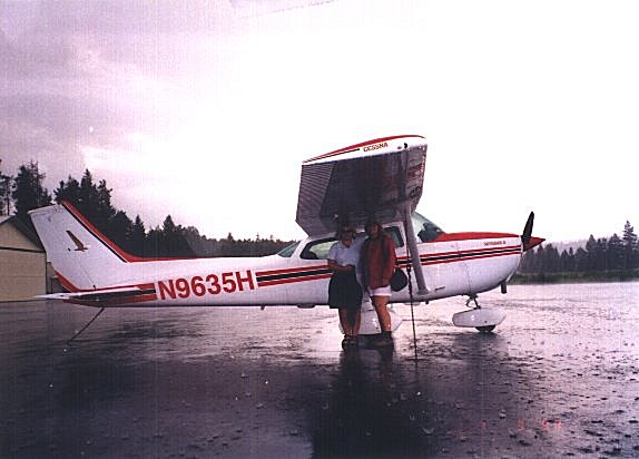 About five minutes after we arrived, as we were unloading, hail started coming
down. It was only about pea to dime sized, but was very heavy. It
made a deafening roar as it reverberated on the metal skin of the plane.
If we had arrived five minutes later, we might have flown into it. I
shuddered at the thought. The ground was covered to a depth of about
¾ inch with hail pellets. We got
in the car and returned to the cabin. On the drive back, I looked up at
the clouds and marveled that they could form so fast.
Man the weather was unpredictable in these parts. My
sister Dianne said she thought I was a really good pilot. I searched her
face to see if she was just being polite or if she really meant it. It
looked like a genuine sentiment on her part. I didn't feel worthy
of the praise. It seemed clear to me I had a lot to learn.
About five minutes after we arrived, as we were unloading, hail started coming
down. It was only about pea to dime sized, but was very heavy. It
made a deafening roar as it reverberated on the metal skin of the plane.
If we had arrived five minutes later, we might have flown into it. I
shuddered at the thought. The ground was covered to a depth of about
¾ inch with hail pellets. We got
in the car and returned to the cabin. On the drive back, I looked up at
the clouds and marveled that they could form so fast.
Man the weather was unpredictable in these parts. My
sister Dianne said she thought I was a really good pilot. I searched her
face to see if she was just being polite or if she really meant it. It
looked like a genuine sentiment on her part. I didn't feel worthy
of the praise. It seemed clear to me I had a lot to learn.
- 7/5 Priest River, ID -> Walla Walla, WA
1.3 hours
Nice flight to Walla2. Dust devils off final. Up and
down a lot.
Well, it was time to head for home. It had been a good visit. My
parents dropped us at the airport. We loaded up and
launched. I had decided to take a different route back to Texas.
Usually, I crossed the Rockies by following Interstate 90 over the Idaho
panhandle and into Montana. There was an alternate route I had looked at
a number of times. It was to fly through Southern Idaho, cross the north
part of Utah up over Bear Lake, pick up Interstate 80 over the continental
divide, on to Cheyenne, Wyoming and then Goodland, Kansas. I had avoided
it on previous trips, because the general elevation of the terrain was much
higher, forcing us to cruise at higher altitudes. The airports along the
route were also at higher elevations, which could give us problems on takeoff.
With a full load of fuel, the airplane was right at gross weight.
Couple that with a high altitude takeoff, and it seemed like an invitation for
problems. There just wasn't as much air for the plane to work with; it
operated closer to the edge, and I didn't like that. Still, some things
could be done to mitigate the risks, and I really wanted to try this route to
see what it was like. This might be my last chance for some years to
come. So, an attempt at this Southern route became the plan. The
first stop was Walla Walla, to get gas and food. We had a pleasant
flight, but encountered several large dust devils on long final approach to
landing. I threaded my way through, doing gentle S-turns. We still
got knocked up and down a lot, sometimes way above glide slope and sometimes
way below. I had to jockey power to stay on track. We landed,
taxied over to the FBO, arranged for gas, and retired to the airport cafe for
a bite.
- 7/5 Walla Walla, WA -> Pocatello, ID
3.7 hours
Good flight to Pocatello. Flew over neat lava formations.
After a mediocre lunch, we went back to the FBO, retrieved our airplane, and
took off destine for Pocatello, Idaho. I started climbing right after
takeoff and continued climbing to 9500 feet. Over Baker City, Oregon, I
started getting a headache and feeling woozy. At first I thought it
might be carbon monoxide, but then realized it could also be hypoxia. We
had been quite high for a while now. I asked Jane how she felt.
She said she was fine. I looked at my fingernails to see if they were
turning blue; an early sign of hypoxia. They were a bit dark, but seemed
basically OK. Nevertheless, I descended to 7500 feet and in about 10
minutes was feeling much better. It must have been the early stages of
hypoxia. I'd never come up against it before. I guess I've spent
too much time living on the low plains of Texas. With Jane and the kids
zonked out, we droned past Boise, Idaho, following highway 84. The land
seemed very dry. Everything was brown and dusty looking. Just west
of Pocatello, right around Minidoka, we began to over fly a series of little
volcanoes. They were really interesting. I dropped down lower to
about 2000 AGL. The largest one was probably a
mile across at the base. They appeared to rise a few hundred feet, at
most, above the surrounding terrain. At the top of each was a little
crater about 30 feet deep. The volcanoes were not cinder cones like you
find around Bend, Oregon. They appeared to be comprised of layer upon
layer of congealed lava. The lava varied in color from grey at the base,
through brown in the mid-sections, and finally black near the top and in the
crater. Apparently, as the lava weathered, it changed color from black
to brown to grey. Some of the volcanoes seemed to have erupted in the
recent past, with slick, shiny, black lava from the crater having run through
channels partway down the sides of the cone. Very cool. I wanted
to drop lower and circle for a while, but our fuel was getting low. Any
lower and we would be out of gliding range of a safe landing area in the event
of a engine failure. I reluctantly passed them by, but would like to go
back someday and hike around in there. It was really, really cool.
One of the neater things I've seen from the air. There were no roads
leading back into there very far, and you just couldn't have seen some of that
stuff except by air. It was late afternoon and very hot when we
landed in Pocatello. We got out of the plane and ambled into the pilot's
lounge. We grabbed a coke and
relaxed a bit, reveling in the technological marvel that is air conditioning. Ahhhh...
- 7/5 Pocatello, ID -> Laramie, WY 3.4
hours
Interesting mountains. Tried for Cheyenne but T-storms got in way.
High winds at Laramie.
After relaxing a bit at Pocatello, we got back in the plane with the plan of
stopping in Cheyenne, Wyoming for the night. It was 6:00 PM now, and we
should arrive in Cheyenne before 10:00. The combination of elevation and
heat made the density altitude close to 5500 feet. During run-up, I
leaned the mixture for peak RPM, then backed off to the rich side a bit.
I was worried about climb performance, and wanted all the power I could get.
We took off without problem. At 500 feet, I enriched the
mixture to help engine cooling, and dropped the nose into a cruise climb.
We picked up some speed and that got more cooling air over the cylinders.
We climbed to 7500 feet, settling on a course that would take us over Bear
Lake in northern Utah. I then planned to intercept highway 80 around the
town of Granger, Wyoming. I found following interstates over
the continental divide a very good idea. In the old days, Indians
had found the easiest way over the mountains. They generally chose
routes which led through low, broad, smooth valleys, where they
could find food and water. It also afforded better protection
from the elements, and kept them at low altitude, making the trek easier. Later on, settlers followed the Indian
trails. Those trails eventually evolved into roads, the roads into railroad
tracks, and the tracks into interstates. This was all good for me.
It meant the best route over the mountains for a little airplane was the same
one the interstate took. This gave me the added benefit of a ready made
airstrip all along the most inhospitable leg of the
flight. If we had to make a forced landing, people would be around
to help us. That would not have been the case had we struck out
cross-country on our own. There's a lot of desolate country out there.
Right around Thatcher, Idaho, we over flew some really interesting terrain.
The hills and layers of rock had been folded and twisted like taffy when the
Rockies were uplifted. I could have stared at it for hours. This
Southern route was proving much more interesting in terms of geology!
We eventually found our way to Granger and turned east following the
interstate. It was getting on to twilight when up ahead in the distance,
I saw much more mountainous terrain. As the sun set and the world became
all shades of grey, it dawned on me that I may have made a mistake. Here
I was heading into unfamiliar rising terrain at night with few airfields along
my route. My planned destination was near the endurance limit of
the plane. The skies were clear now, but if the weather closed down,
I'd be in an awful pinch. Although the moon was due to rise at 6:00 PM,
it wouldn't climb high enough over the mountains to provide much light until
maybe 9:00 PM...it would be very dark most of the flight. Generally speaking, the
surrounding terrain further along my path would be too high to climb over.
What a pathetic lack of foresight; how could I have made such a strategic
blunder. Sure, everything would likely turn out alright, but I was
needlessly stacking the deck against myself without even realizing it until it
was too late. I was beginning to doubt my ability to make sound
judgments. I should have stopped in Pocatello for the night. Maybe
if I survived enough of these stupid mistakes, I'd gain enough experience to
become a competent pilot. One of these days, one of these stupid
mistakes would catch up with me and that would be the end of it. The
airplane was safe enough if flown by a competent, conservative pilot, but I
had been regularly proving rather unworthy of that moniker. Hopefully, I was learning
though. Back to the potential pickle I'd gotten myself in. I
needed a fall-back plan, just in case the worst happened. The worst that
could happen would be: stuck in a narrow valley, forced down low under a
low ceiling, not being able to see the walls of the valley because of darkness
and/or rain, and not being able to risk making a 180º
turn for fear of impacting the valley walls. I
decided that if I couldn't clearly see the mountains around me, I would fly
directly over the interstate. The lights of the cars provided a definite
ground reference. If I avoided collision with the cars, I would also
avoid collision with the ground. Furthermore, if the weather closed
down, I would descend to maintain visual contact with the interstate, NO
MATTER WHAT. I would have to fly straight ahead into whatever came,
unless I could clearly see the valley walls and assure myself that I had
enough room to turn around. If I was forced down to within 100 feet of
the interstate, I would land on the interstate as soon as practical rather
than risk collision with high tension lines that occasionally cross it.
With these contingency plans in place, I pressed on. The night did indeed
prove to be very dark, but I could still make out the lay of the land in the
gloom. Passing Rawlins, Wyoming, we flew under some high scattered
altocumulus, about 3/10ths coverage. That made the night even
darker. Everything was proceeding OK so far. As we passed
McFadden, Wyoming, the cloud cover became more dense and lowered a bit, but
way in the distance, I could see the lights of Laramie. Just a bit
further on would be Cheyenne. We were getting close. About 20
miles out of Laramie, I saw a flicker of light up ahead on the horizon.
Lightning! Now I really began to worry. It seemed my worst fears
were about to become reality. Still, the lights of Laramie were shining
clearly in the distance. The thunderstorm must be beyond Laramie.
As we got closer, I could see the thunderstorm was indeed on the far side of
Laramie, blocking our route to Cheyenne. We would have to land at
Laramie instead. I was further alarmed when lightning flashed about 10
miles to the left and right of us. It looked like we were becoming
encircled by thunderstorms. If I couldn't land at Laramie for some
reason, I would have to turn back to Rawlins and I hoped the thunderstorms
wouldn't close off our path of retreat. I got on the radio and called
ahead to try to get a reading on the weather from someone at Laramie.
Laramie does not have a control tower, so I tried calling on the Unicom
frequency. Almost immediately an FSS weather observer answered our call;
what a stroke of luck, especially this late at night. When she briefed
me on the weather, my heart stopped. The winds were 40 knots with gusts
to 55! It would be very difficult to land in that kind of wind.
Even if I got the plane on the ground, I couldn't imagine how to taxi it.
There would be no way to turn it without getting blown over, and I would never
be able to get out to tie it down. Sheezh...the airplane stalled at 42
knots. I could just hover down to a parking spot! If I couldn't
manage a landing at Laramie, I would have to turn back to Rawlins. I
would have time for two landing attempts before my fuel situation got
critical. There wouldn't be enough fuel to try it a third time and
still comfortably make it back to Rawlins. I entered the pattern at
Laramie. I was expecting to carry huge crab angles to maintain proper
ground track, but I just didn't need it. The windsock was standing out
stiff as a board, but it didn't seem like a 40 knot wind. With that
hairy go-around at Priest River still in my mind, I carried a lot of power and
only ten degrees of flaps through the pattern. On final, I had to
correct for a cross wind, but the wind was steady and although strong,
certainly not 40 knots. The final approach proceeded so well, that I
went for it. I cut power and touched down without problem. Whew!
We cleared the runway and headed for the transient parking area. The
wind was rocking the airplane back and forth, making it hard to taxi but it
could be done. I estimated the wind to be a relatively steady 25-30 knots. No problem. We
taxied up and tied down. I found a phone and called a hotel in town.
They sent a car out to get us. I lived to fly another day.
Hopefully, I was now wiser for the experience. It would be a great waste
of stress hormones, if I failed to learn anything from this.
- 7/6 Laramie, WY -> McCook, NB 2.5
hours
Tried for LBL but line of 60k T-storms forced us east. Flew through
rain.
The day dawned overcast with light rain. By the time we packed up and
got breakfast, the ceiling had lifted quite a bit and the rain had stopped.
The sun even peeked through occasional breaks in the overcast. We headed
to the airport and loaded the plane. While in the pilot's lounge
planning the next leg of the flight, I ran into a woman flight instructor.
She seemed to be a hyperactive ball of nervous energy. There were
several pilots in the lounge, doing the same thing I was doing. She came
around to each in
turn, asking all kinds of questions and offering advise. She admonished everyone to be careful of the effects of altitude on aircraft performance. Told
anyone who would listen to lean the engine on run-up. On and on. She was
really making a nuisance of herself. A guy quietly stepped out of the lounge
and made a break for his airplane. She followed him out to the ramp. He fired
up and taxied out to the runway. As he started his takeoff roll, she seemed
to get upset. She talked rapidly and writhed about with nervous
tension...what in the world did she think was going to happen? The guy
departed without incident. A few minutes later, another guy departed and she seemed to get quite
agitated again. I just couldn't stand to watch. Maybe she had recently seen
some horrific crash or something. She sure seemed to be carrying something
around inside her; either that or she was mentally ill. We got in the
plane and taxied to the runway for our shot at oblivion. The field
elevation at Laramie is 7500 feet...very high. I'd never taken off from
an airport this high before, but the temperature was only 50 degrees making
the air denser, and we had plenty of runway. There was almost no wind.
With the engine leaned to maximum RPM, I taxied onto the runway and took off.
No problem. The takeoff run didn't seem appreciably longer, and the
airplane climbed at about 450 feet per minute. Not too bad. We
turned east, destine for Liberal, Kansas. I tried to stay as low as
practical to avoid hypoxia. For about 30 minutes, we flew between 8000
and 9000 feet, contouring the terrain. East of Cheyenne, Wyoming, we
picked up some light rain, but the visibility was still a good 5-6 miles under
the overcast. With the worst of the mountains behind us, I was able to
descend. We were over open prairie now, so I felt it was OK to leave
Interstate 80 behind. We struck out cross country, flew past Sterling
headed for Burlington, Garden City, and points further South. Around
Yuma, Colorado, we flew out from under the overcast and into clear skies.
Visibility was now great...better than 30 miles. Out in the distance, I
could see a line of huge thunderstorms on the horizon. Monitoring EFAS,
I discovered this was an almost solid line of
thunderstorms stretching from Goodland, Kansas, northwest to Colby Nebraska.
Maximum tops were 60,000 feet, so these were real monsters...welcome to the
mid-west! The IFR guys were probing the line, trying to find a way through,
and some were making it. I immediately altered course and flew directly
east. The line was rapidly lengthening and extending northeast. If I was
fast enough, I could do an end-run around the line, right
around McCook, Nebraska. We arrived at McCook just ahead of the line. I
needed to get gas because the next fuel stop was quite a bit
further on. If we stopped here for fuel, the approaching line might catch us and
pin us down. Well, I needed fuel and that was that. We flew through
some light rain just before entering the pattern at McCook. The clouds 10
miles Southwest of the field looked black and mean. We taxied in and arranged
to get gas. I shut off the fuel valve, and the FBO guys went to work. Turning off the fuel valve prevents the tanks from cross
feeding during fueling, and lets you squeeze in another gallon or two. After a few minutes, I went outside and was amazed to see the
line had extended rapidly and was now almost overhead. It started
raining hard. Well, we were caught. There was no point in trying to take off
now, we had to wait out the weather. We grabbed a courtesy car and headed
into town while the FBO guys towed the plane to a hanger for safekeeping.
We stopped at Taco Bell for a leisurely lunch. I wondered what to do. The
line would blow completely through soon. We'd then be on the back side of it
again, and would need to cross over. At the rate the line was extending
northeast, I doubted I would be able to catch it and do an end-run again.
Seemed like my only option was to fly Southwest down the back side of the
line, looking for a hole. We should be able to make it to Garden City,
Oklahoma, and if we had not found a break in the line at that point, I could land
and re-assess the situation there. I decided to try this plan.
- 7/6 McCook, NB -> Oklahoma City, OK
3.8 hours
Found gap in T-storm line. Dodged T-storms all the way to PWA.
We returned to the airport and looked at the weather radar. There appeared
to be breaks in the line, however, it wasn't entirely clear how wide the holes
were. I didn't want
to thread the needle between 60,000 foot monsters...the break would have to be
a good 20 miles wide before I'd try it. I walked to the hanger with the FBO
guys to retrieve the plane. I got in, fired up, and started taxiing
to the pilot lounge to pick up my passengers. About halfway there, the
engine quit. I tried to restart it several times but couldn't. What was
wrong? Mixture rich, magnetos on, carb heat off, good solid cranking
from the starter. Why wouldn't the engine run? I got it to sputter
a couple of times, but that was it. I sat there for several embarrassing
minutes trying to figure out what was going on. I looked down and saw
the fuel valve closed. Sheezh, the fuel valve! Of
course, I had closed the valve when we got gas. I hadn't used the
engine starting checklist and had forgotten to open the valve. I had
only planned to taxi to the pilot's lounge and shutdown. With the
fuel turned on, the engine started right away. There's a lesson here
about using the checklist all the time. How embarrassing. I
picked up my passengers and took off headed Southwest. We were flying
under partly cloudy skies with good ceiling and visibility. Fifteen
miles to our left loomed the monsters. I watched for holes in the line.
I saw a couple, but they were very narrow and would have pinched us between a
couple of thunderstorms. Finally, near Winona, Kansas, I found a huge
hole. It had to be at least 25 miles wide. There were some wispy
clouds and light rain hanging over it, but I could see sunshine on the
other side. I turned left and went through. I slowed to
maneuvering speed just in case any severe turbulence lurked inside the line;
there was only moderate chop and a few rollers. We popped out the other side around Utica,
Kansas. I set a course for Oklahoma City, Oklahoma. Enroute, I had
to dodge several thunderstorms, but nothing like what we had just
come through. On our way to Oklahoma City, I skirted a couple of
restricted and prohibited areas. The air was pretty clear, and I looked
carefully at the ground in those restricted areas. I saw nothing; no
roads, trails, or signs of disturbance of any kind. No evidence that there had ever
been any activity on the ground. I always thought these prohibited
areas were there to protect something. If there was
anything there, it was well hidden. We landed in Oklahoma City at dusk, got fuel, and were ready to go 30 minutes later.
- 7/6 Oklahoma City, OK -> Dallas, TX
2.5 hours
Easy night flight; no clouds. ADS field closed; diverted to Love.
We had an easy, uneventful night flight to Dallas. No wind, turbulence,
clouds, or anything. I have to admit that I felt a bit tired after
worrying all day about thunderstorms. About 15 miles out from Addison, I
listened to ATIS and found the airport had been closed for maintenance that
evening. I diverted to Love field in downtown Dallas. It's a big
airport that serves scheduled airline traffic. I landed, taxied to the
transient parking area, and tied down. It was about 11:30 at night, and
my car was way up in Addison. The whole family was beat. I tumbled
out of the plane and started walking to see if I could find a phone.
Maybe we could get a taxi to come get us. I took Serena with me and
left Jane and Katie with the plane. Serena and I walked for what seemed
like a mile before we came to an FBO that was open all night. I called a
taxi. After a few minutes, it arrived, collected Serena and I, and drove
out to the airplane. We unloaded the plane and piled all our stuff into
the taxi. The driver dropped us at Addison airport next to our car.
We transferred all our stuff to the car, paid the taxi driver, and went home.
Wow, what a trip. We all collapsed in bed and slept like logs.
- 7/7 Dallas, TX -> Addison, TX 0.4
hours
Ferried plane back to ADS. Twin landed gear up at ADS.
The next morning, I had to get up, go down to Love field, and ferry the
airplane back to Addison. Jane drove me down and dropped me at the
plane. She immediately turned around and headed to Addison where she
would pick me up. I taxied to the FBO and topped off the
tanks. I got in the plane and took off. My takeoff was actually
pretty bad. There was a moderate gusty cross wind, and I didn't exactly
deal with it very well. I kind of skidded the plane sideways on takeoff
as I allowed the wind to pick up a wing. Man, I know I can fly
better than that! I must have been tired, bleary, or something. I
zipped up to Addison and landed. As I was taxiing to park, I saw a
Beech Baron on it's belly in the grass strip between the runway and taxiway. It had apparently landed gear up and skidded off the runway
into the grass. I was glad to be flying a fixed gear airplane.
After tying down, I went into FlightLine and talked to Scott, the proprietor.
He asked me how many quarts of oil I used on the trip. I had only used 2
quarts, and that counted topping off the oil at Love field. He was
astounded, and so was I. The plane had a really good engine in it, and I
usually ran it at 75% power during cruise. He asked me about weather,
and I told him about the hail storm at Priest River. His
eyes bulged out a bit. I told him it was only pea sized hail and didn't
do any damage, but he went out to inspect the plane anyway. Satisfied
all was well, we returned to the office, swapping stories of aviation
derring-do. Scott was amazed that I would take such a long trip in a
Cessna 172. "Why don't you fly something faster?," he marveled.
Well, because it's about the journey, not the destination. After about
20 minutes, Jane arrived to pick me up. Thus ended our
odyssey.
Some facts about the trip:
- Flying time from Addison, TX to Walla Walla, WA - 16.4 hours
- Flying time while fooling around up there - 10.1 hours
- Flying time from Priest River, ID to Addison, TX - 17.6 hours
- Total flying time altogether - 44.1 hours
- Flying time at night - 4.0 hours
- Number of landings - 23
- Number of legs - 23
- Number of legs which required flying through rain - 4
- Number of legs in which someone became nauseated - 1
- Quantity of fuel consumed - 346.6 gallons
- Average fuel consumption - 7.86 gallons/hour
- Total fuel cost - $752.87
- Total oil burned: 2 quarts!
Some things I learned on the trip:
- Don't stop at unfamiliar little po-dunk airports for gas. Try to
stop at larger airports. I've had too many bad experiences trying to get
gas at little country airports, especially on the week-ends.
- Be flexible and make contingency plans. You need to "go with the
flow" when flying long cross countries. You're going to be thrown a lot
of curve balls, and you have to be prepared to think on your feet and make new
plans the minute conditions change. The situation is dynamic, and your thinking should be fluid to match. It's not
just the tactical aspect of flying the plane, it's thinking ahead and
planning strategy; a dynamic mix of tactics and strategy. Most of all,
force yourself to continuously think of what could go wrong to spoil your
plan, and come up with alternatives. It's better to make a contingency
plan ahead of time rather than trying to come up with something under duress. As you're droning along, you have
plenty of time to mentally probe the situation ahead; use that time. It
will save your butt some day.
- Think BEFORE you takeoff. Before you get out to the airplane and are
distracted with the preflight ritual, sit down in a quiet place and mentally
go over the whole flight. Evaluate what could go wrong. Think of
the terrain, weather, lighting, fuel endurance, navigation problems and the
likelihood that one or a combination of these factors could endanger the
flight. Then make a deliberate decision whether to go or not.
Don't do like I did in Pocatello and just pile in and blast off. Think
first, then act. For me, this has been the hardest thing to discipline
myself to do, because I seem to just instinctively act first. There's an
old pilot's saying that goes, "Never let your airplane take you somewhere your
brain hasn't already visited."
- Stay sharp on your go-around skills. You never know when you might
need them. Always be prepared to go around, and once you make the
decision, don't hesitate, just do it. I shudder to think what would have
happened had I hesitated during that go-around at Priest River. I've
now adopted the attitude that I am definitely going to execute a go-around on
every approach. Only if everything is compellingly serene will I proceed
to land.
|